See how far the water went after heavy rain.
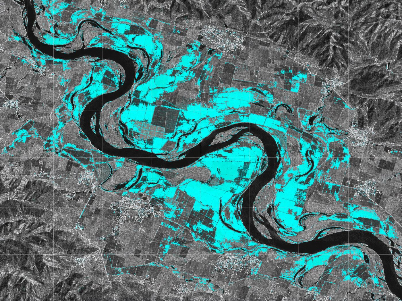
No waiting for clouds to clear. Radar compares water with its usual extent and maps new water (possible flooding) in 10 m cells.
The challenge
When it rains, the sky is closed.
Right after heavy rain, cloud makes it hard to see wide areas with optical satellites or drones, and field checks take time.
Cloud
Optical satellites need clear skies to see the ground.
Wide areas
Flooding along rivers is hard to see at once from the ground.
No baseline
Without comparing with usual water, it is hard to tell what is newly flooded.
With BASIN
A new-water map against the usual extent.
BASIN separates water and land in Sentinel-1 radar images and compares them with the usual (median) water extent at the same place to mark new water.
- Radar works through cloud and at night
- 10 m cells, every 6 to 12 days
- Permanent water, new water (possible flooding) and dry cells
- For disaster teams and insurers checking affected areas
FAQ
Frequently asked questions
Is it real time?
No. It follows satellite passes every 6 to 12 days. It is for checking flood extent widely after rain, not for real-time monitoring.
Who is it for?
Local disaster teams, river managers and insurers who need to see flood extent over wide areas.
Is it the same product as the bloom service?
Yes. It is the water surface and flood feature of the same BASIN platform, and bloom spread paths are calculated inside this water map.
Related pages
Work with us
Start with a satellite screening of your water.
We screen your reservoirs and intakes from public satellite data first, then compare the results with your own field measurements. No equipment needs to be installed.