Water intake bloom forecasts, and what an arrival date changes
If you run treatment plants and intakes, the information that buys the most response time is a water intake algal bloom forecast.
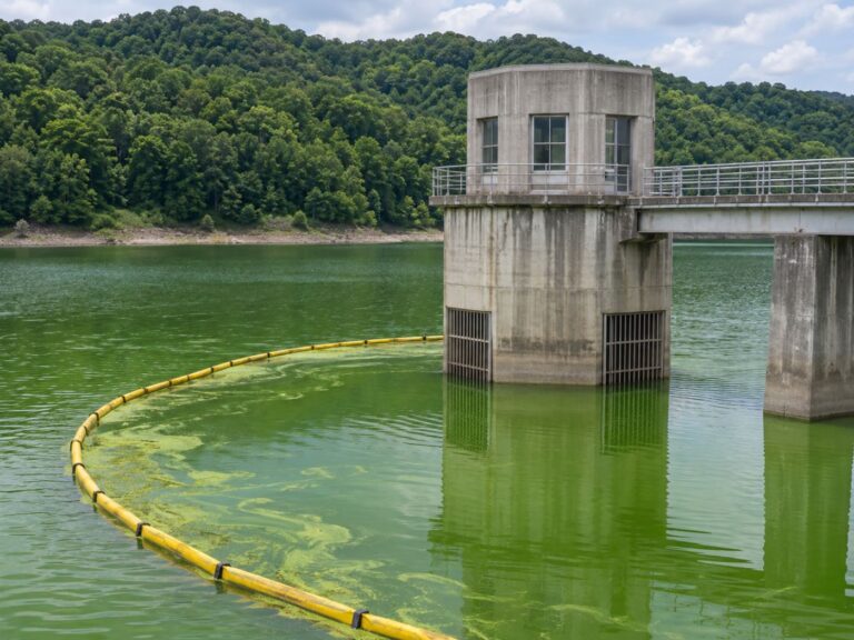
Treatment plants always meet a bloom last. While it forms and spreads in the lake upstream it is hard to see, and the moment it reaches the intake, treatment load and odour complaints arrive together.
What if you knew three days in advance when the bloom would reach the intake? You could change intake depth, set booms and prepare activated carbon before the bloom arrives, responding with far more room using the same people and chemicals.
Below we explain how the arrival date is calculated, what changes when you know in advance, how to read a forecast, and how a BASIN pilot checks it. If you want more time to respond at your intake, read on.

Category: Intakes & alerts
A water intake algal bloom forecast calculates spread paths and arrival dates
Blooms float near the surface, are pushed by wind and carried by flow. Knowing where a bloom is now, plus wind and flow, lets you calculate where it will go.
BASIN calculates this movement only inside the daily water surface made from radar. That keeps paths off dry land and lets them follow real channels, producing spread maps from D+1 to D+7.
The day the spread map reaches an intake is the expected arrival date. The main direction of travel is shown as well, which helps decide where to place booms.
Wind comes from the public forecasts of Open-Meteo, and residence time from the Copernicus GloFAS river discharge data. When the operator’s release data are connected, those are used first.
How the intake arrival date is calculated
Temperature, N, P, sunlight and residence time show growth conditions.
With weather forecasts, alert levels 3–7 days ahead.
Wind and flow move the bloom inside the water mask.
The day the path reaches the intake.
Three days before a bloom arrives change the options for intake and treatment
Blooms usually gather densely near the surface. Knowing in advance, you can draw water from deeper below. Algae booms also work best when set before the bloom arrives.
Treatment changes too. Instead of high doses of activated carbon and coagulant every day, you can prepare and concentrate them on the days the bloom will come in, putting chemicals and power where they are needed.
That creates room to reduce intake stoppages and taste-and-odour complaints. Sampling and patrols can also be focused on the right places and days, cutting vehicle trips.
A record builds up as well. Once you have a history of which forecast you saw and what you did, the next bloom season can draw on evidence about which actions worked in similar conditions.
Read forecasts as ranges and confirm them with measurements
Every forecast carries uncertainty, so BASIN shows a range from a low case (p10) to a high case (p90) instead of one value, together with the probability of exceeding the threshold.
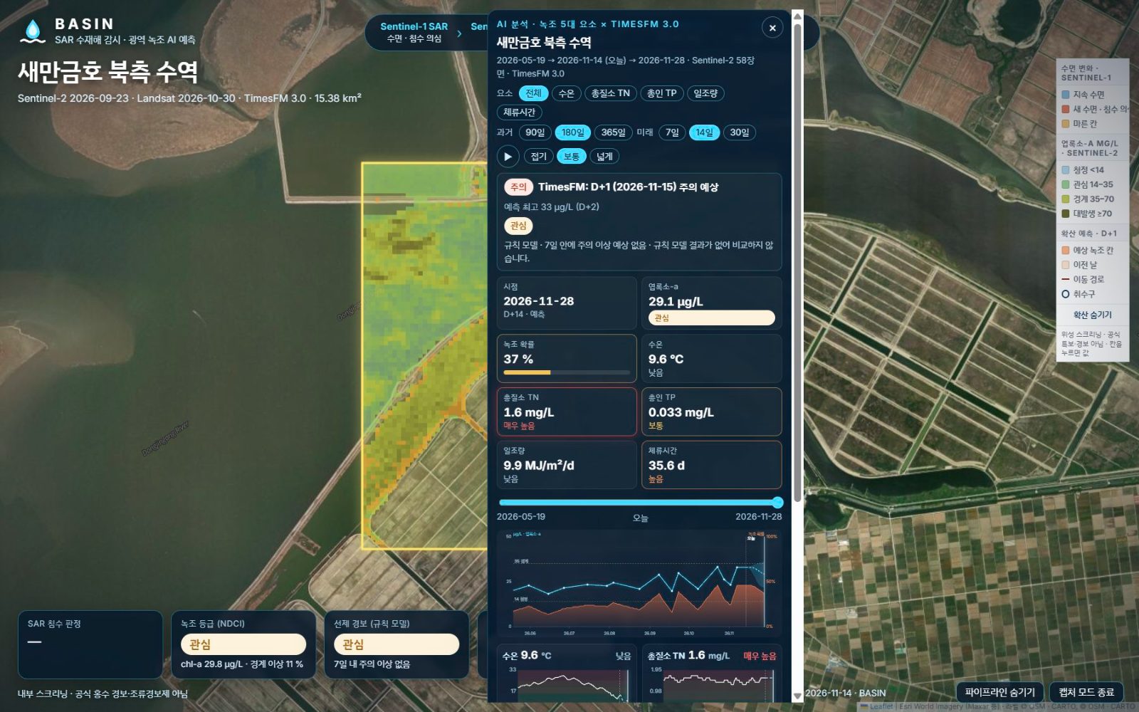
For longer planning, the AI time-series forecast adds past satellite time series and the five drivers to Google’s TimesFM foundation model, forecasting 7, 14 and 30 days ahead for each grid cell.
The screen below shows northern Saemangeum Lake. 58 Sentinel-2 scenes from May to November 2026 are joined into one chart of chlorophyll and bloom probability for the past and the next 14 days, and the map grid can be played back day by day.
Whether a forecast was right is checked against measurements. Each time public monitoring data arrive, BASIN compares them with its results, recalculates error and alert recall, and shows a validation table for each water body.
A BASIN pilot compares forecasts and measurements every day at dams and intakes
BASIN starts with a paid pilot, for example two bloom-prone dams and one intake, connecting automatic stations and water level and release data.
Through the May to September bloom season, forecasts and measurements are compared every day. We plan to verify targets such as a 3-day-ahead alert hit rate of at least 70% and alert-level recall of at least 80%.
At the start, intake locations are marked on the map with the operator, and the operator’s bloom procedures are matched to the alert levels. A monthly review keeps alerts and recommended actions in the operators’ own language.
At the end of the pilot you have a report, validation tables and alert levels that reflect your procedures, and can continue with a subscription per intake.
That covers how intake arrival dates are calculated and what changes when you know in advance; how to test it together is described on the pilot partnership page.
Frequently asked questions
How accurate is the arrival date?
It depends on wind, flow and the accuracy of weather forecasts. In a pilot we compare it with actual arrivals to measure the error.
What if we have several intakes?
Mark each intake and BASIN calculates an arrival date for each. Grid forecasts also show which side will be at risk first.
Does it work for river intakes?
Yes, river reaches can be registered as water bodies. In fast-flowing reaches residence time is short and blooms build differently from lakes, which we check together in a pilot.
Want to see your reservoir or intake from above first?
We can start with a satellite screening of your water bodies and compare it with your own field records.
Discuss a pilot →Edited and answered by the MomentCube BASIN team / james@momentcube.com · +82-32-212-1011