See where algal blooms will spread, days ahead.
BASIN screens whole reservoirs and water intakes from satellite, weather and river data, and tells you the alert level 3 to 7 days ahead and when a bloom is expected to reach your intake. No equipment on site.
The problem
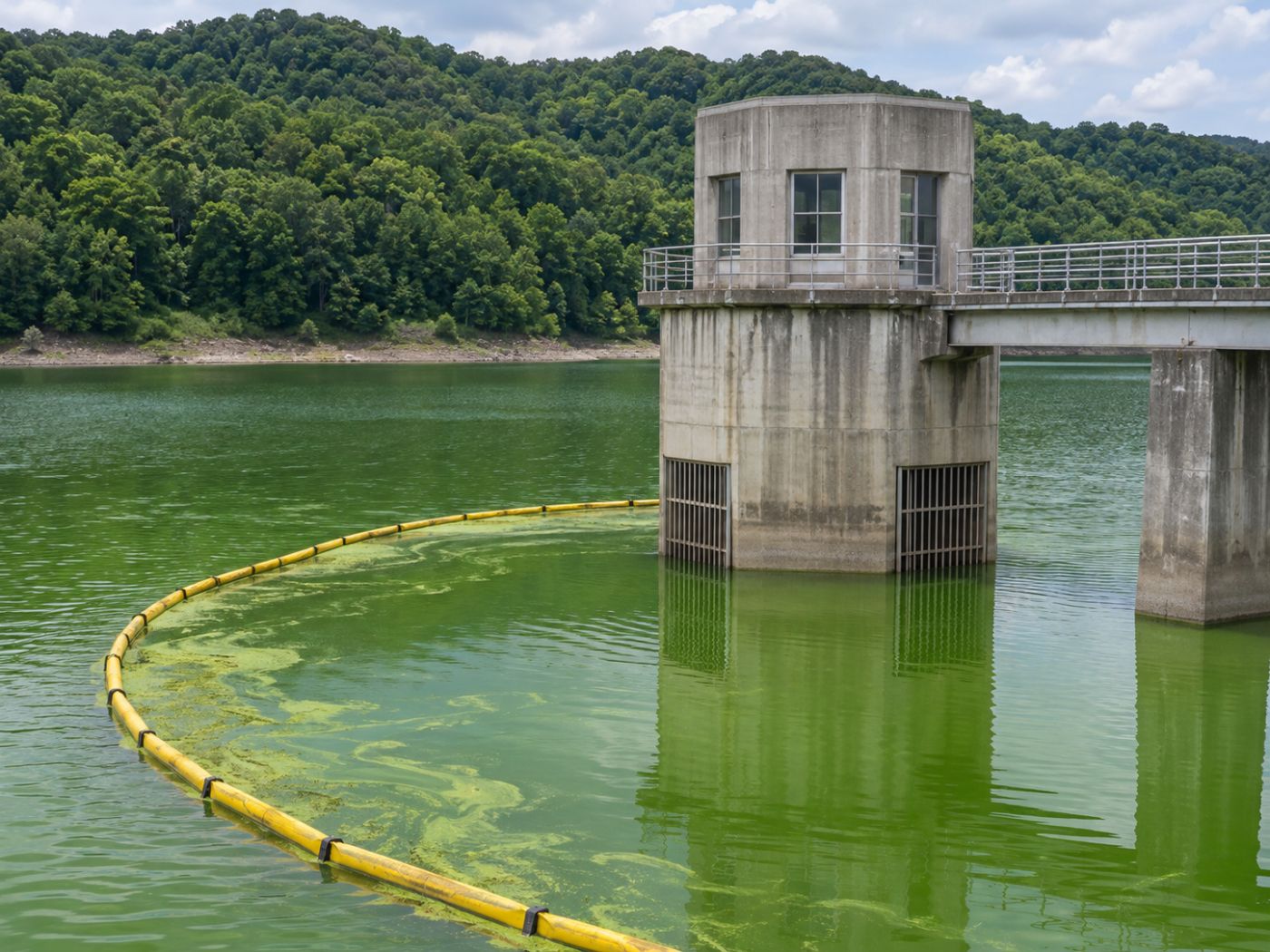
Blooms spread across whole lakes; monitoring happens at a few points.
Blooms are becoming more frequent with climate change, yet water management still relies on a handful of points measured after the fact and on field patrols.
Sparse sampling
Field sampling covers few points and days, so blooms that spread in days can be missed.
Point-only stations
Automatic stations measure only where they are installed. The wide water between them stays blank.
Maps of “today” only
Satellite bloom maps show where water is green today, not where it will spread in the coming days.
Two stages
Find it wide first, then decide precisely on site.
Wide-area screening (SaaS) and on-site verification work separately or together, from satellite to site and from site to satellite.
Wide-area screening
Satellite, weather and river data find risky water bodies and intakes first, to the same standard everywhere, with no equipment.
On-site verification
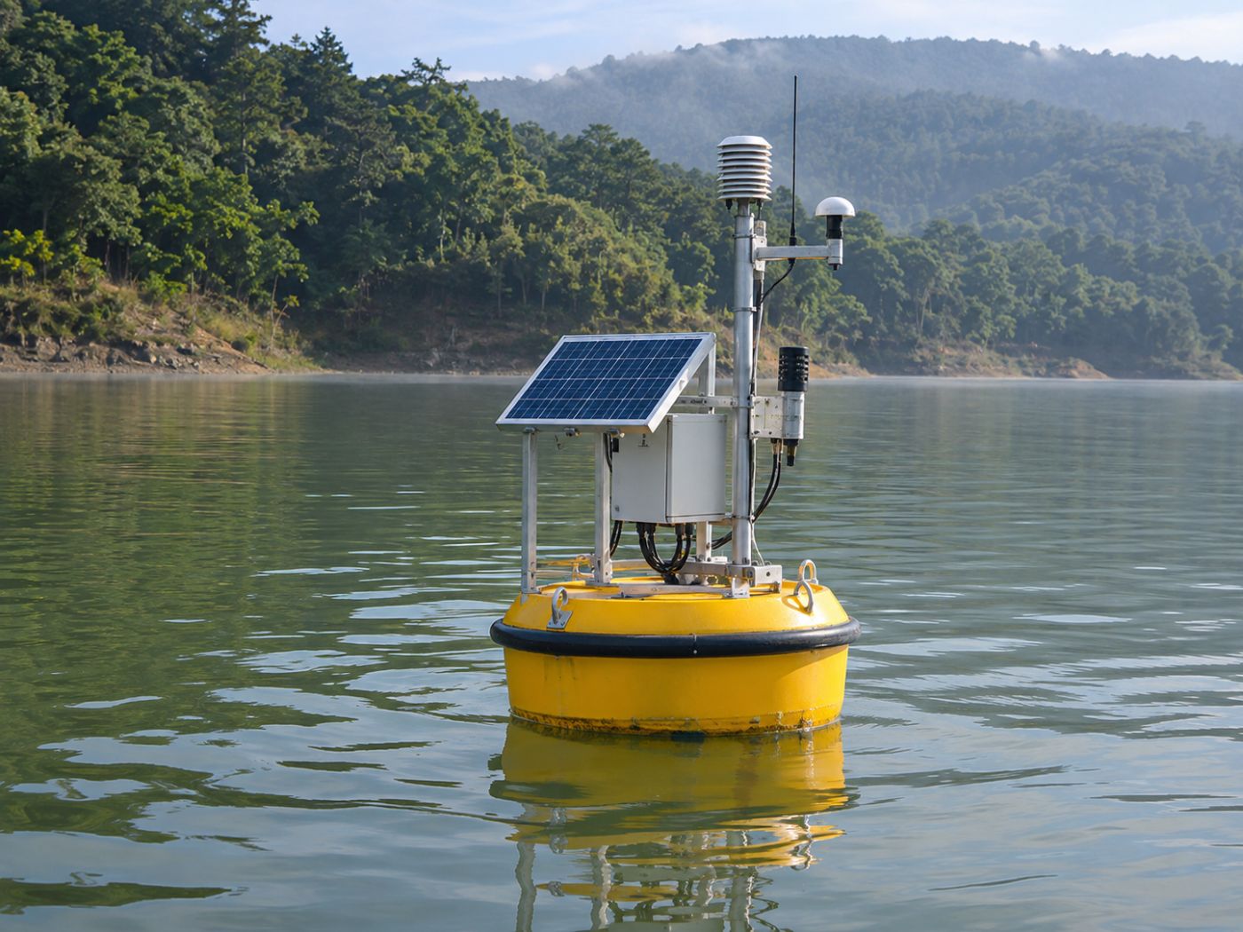
Field measurements, sampling and CCTV, combined with satellite and upstream context, decide when to act.
Features
The whole bloom response on one screen.
Watch the water surface, read concentration, calculate the causes, forecast days ahead and check yourself against measurements.
Water surface & flood watch
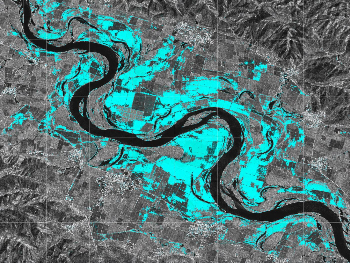
Radar sees water through cloud and at night, flagging new and shrinking water.
Algal bloom map
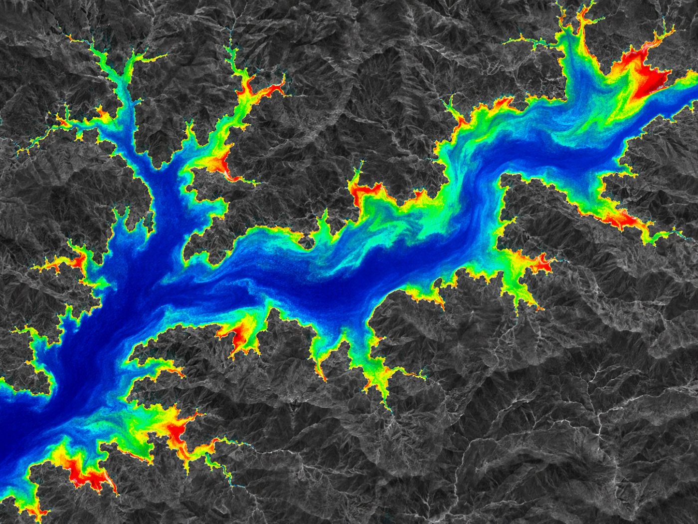
Chlorophyll-a estimated for every 10 m cell, in four levels from clear to bloom.
Five bloom drivers
Temperature, N, P, sunlight and residence time, calculated every day.
Early warning & spread
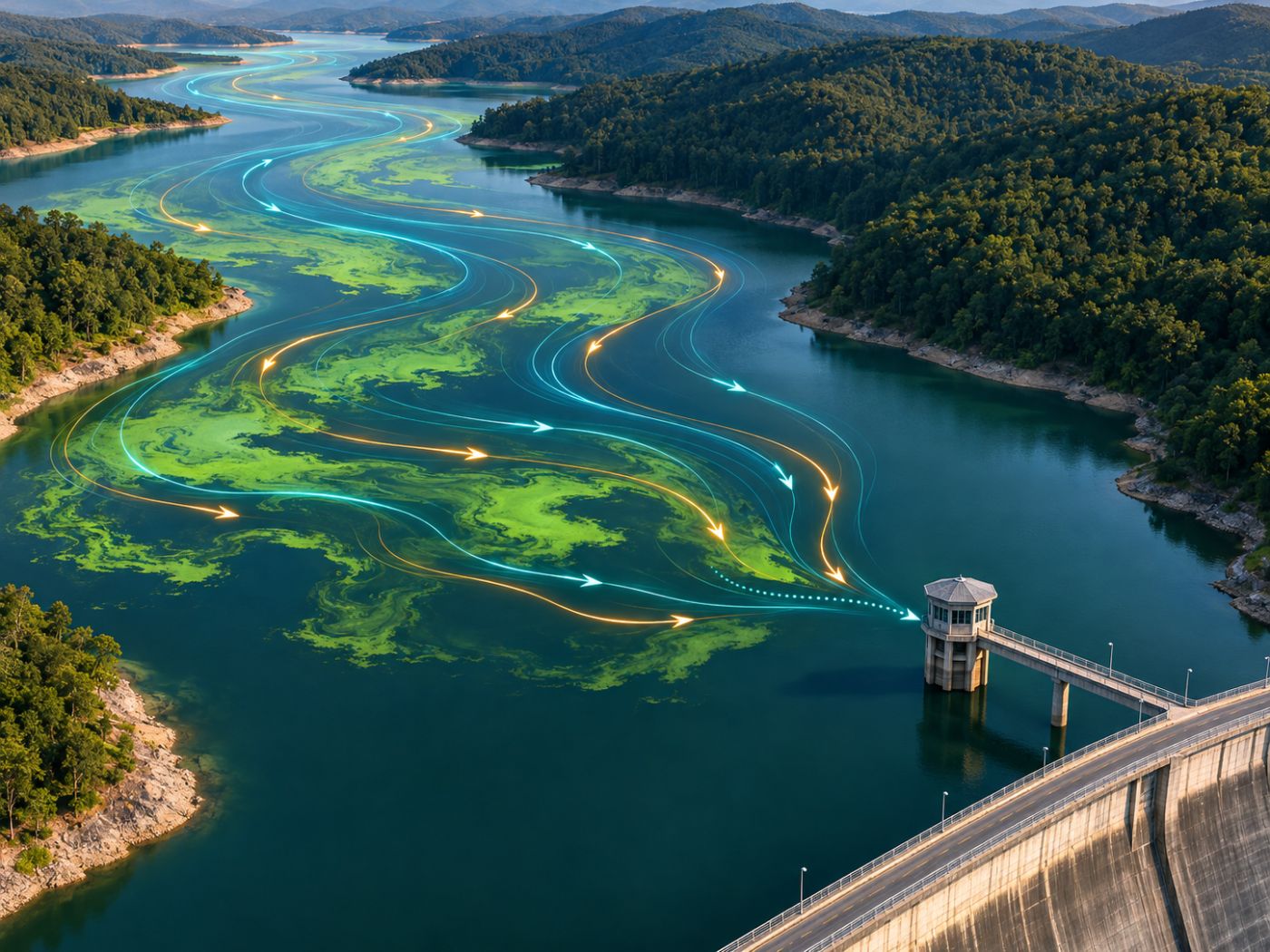
Alert levels 3–7 days ahead, D+1 to D+7 spread paths and intake arrival dates.
AI time-series forecast
Concentration ranges and bloom probability 7, 14 and 30 days ahead, cell by cell.
Automatic validation
Error, recall and F1 against public monitoring data, per water body.
How it works
From orbit to the water intake, in four steps.
Register
Draw the lakes, river reaches and intakes to watch.
Measure from space
Radar for water, optical for bloom concentration, and temperature, measurements and weather for the five drivers.
Forecast & alert
Alert levels 3–7 days ahead, spread paths and expected intake arrival dates.
Check & validate
Confirm on site and recalculate accuracy automatically against public measurements.
Built on free public satellites and public data
Pilot monitoring
Already running on five water bodies.
Our earlier R&D runs in the cloud, monitoring about 75 km² across five Korean water bodies from public satellite data.
Paldang Lake
Major source for the Seoul area
Daecheong Lake
Major source for Daejeon and Chungcheong
Soyang Lake
Multipurpose dam lake, upper North Han
Nakdong (Mulgeum, Maeri)
Intake reach for Busan and South Gyeongsang
Saemangeum Lake
Lake inside the Saemangeum seawall
~75 km²
Total pilot area
These are the BASIN team’s own pilots, not client deployments. Accuracy figures will be published after an official pilot.
Who it is for
Built for the people who manage water.
Dams and reservoirs, intakes and treatment plants, flood checks and water projects abroad, all on one platform.
- Dams and reservoirs: the whole lake, every day
- Water intakes and treatment plants: prepare with arrival dates
- Flood extent checks: new-water maps after rain
- Overseas dams and water ODA: start by registering the water body
Why BASIN
Not a status map, but grounds for action.
Sampling and stations give precise point values. BASIN fills the wide area between them and the days ahead.
| Automatic stations | Satellite bloom status maps | BASIN | |
|---|---|---|---|
| Coverage | Installed points | Whole water body | Whole water body (10 m cells) |
| Days-ahead forecast | None | Usually none | 3–7-day alerts, 7/14/30-day grid forecasts |
| Spread & intake arrival | None | Usually none | D+1 to D+7, arrival date |
| Explains the cause | Measured items | Usually none | Five-driver status table |
| Accuracy check | Reference data | Up to the user | Automatic validation table |
Typical characteristics; specific organisations and products may differ. Full comparison
Next step
Proving it in numbers, on real water.
In a paid pilot we compare forecasts with measurements every day through the bloom season and verify these targets officially.
Pilot design
Choose water bodies, connect stations, levels and releases, build in response procedures.
Bloom season
Daily forecast vs. measurement from May to September; on-site checks for anomalies.
Productisation
Pilot report, subscriptions per intake, integration API.
Scale
Municipal treatment plants and water ODA projects abroad.
≤ 10 µg/L
Chlorophyll-a mean absolute error
≥ 80%
Alert-level recall
≥ 70%
3-day-ahead alert hit rate
≥ 90%
Radar water detection accuracy
The company
A team that already runs AI on real sites.
BASIN is built by MomentCube, an industrial AI company. It combines our video and sensor AI monitoring with satellite data.
3 lead R&D projects
Switchgear predictive maintenance, context-aware safety AI, Safety4Cut with NVIDIA.
3 registered patents
AI safety management, autonomous equipment management, automatic reports.
Public sites
AI fire and safety monitoring adopted by Incheon Environmental Corporation.
Venture company
Innovation growth type, dedicated R&D department.
FAQ
Frequently asked questions
What is BASIN?
BASIN is MomentCube’s satellite AI service for early algal bloom response. It has two stages: wide-area screening (SaaS) that finds risky water bodies and intakes from satellite, weather and river data, and on-site verification that decides when to act from field measurements, sampling and CCTV.
Do we need to install equipment?
No. BASIN starts from satellites and public data and runs in a web browser, with nothing installed on site.
Which satellites and data does it use?
Free public satellites such as Sentinel-1 radar, Sentinel-2 optical and Landsat surface temperature, plus public water quality measurements, weather data and forecasts, and flow and release data.
Does it replace official algae alerts?
No. Official alerts are based on cyanobacteria cell counts from field sampling. BASIN is a screening and forecasting tool that shows where concentration will rise first and how it may change over the coming days.
What about cloudy days?
Optical satellites cannot read bloom concentration under cloud. BASIN keeps watching the water surface with radar and continues alerts from temperature, nutrients, sunlight, residence time and weather forecasts.
How far ahead does it look?
Early warning gives alert levels 3 to 7 days ahead every day. Spread paths cover D+1 to D+7, and the AI forecast looks 7, 14 and 30 days ahead for each grid cell.
Insights
BASIN blog
Water intake bloom forecasts, and what an arrival date changes
How the day a bloom reaches an intake can be calculated in advance, and how three days of warning change intake and…
Algae alert schemes, and where satellite screening fits in
How algae alert schemes are triggered and what changes at each level, and how satellite screening fills the gaps between sampling points…
Satellite algal bloom monitoring, reading chlorophyll from space
How satellites estimate chlorophyll-a from water colour, the limits of cloud and shorelines, and how results are checked against field measurements.
Work with us
Start with a satellite screening of your water.
We screen your reservoirs and intakes from public satellite data first, then compare the results with your own field measurements. No equipment needs to be installed.